
Note to readers •This story is made possible through a partnership between The Salt Lake Tribune and Grist, a nonprofit environmental media organization.
This story is also an excerpt from the Open Lands newsletter, delivered to inboxes every week. For a sneak peek from the environment team about what we’re working on and news we’re following, sign up to have Open Lands delivered to your inbox.
Good morning readers! Leia Larsen here, with some insights on this year’s weather whiplash and what it means for the summer ahead.
In short, there’s not a lot of great news.
I spoke last week with Jon Meyer, the Utah Climate Center’s assistant state climatologist.
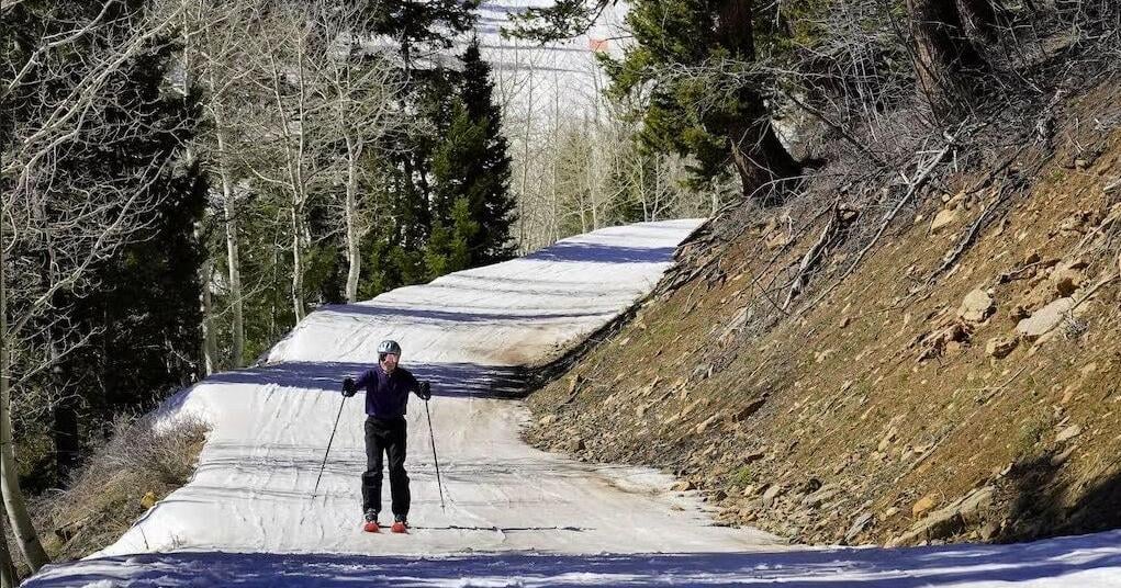
I doubt many of you have forgotten what an unusual six months we’ve had, but let’s recap. First, we had the winter that barely was – in my decade-plus skiing at Snowbasin, I’d never before seen conditions so dire, or folks boating on Pineview in the middle of February.
Then March came at us like an anathema, with day after day of record-high temperatures statewide. I went down to the desert southwest to enjoy some spring biking and nearly wilted in conditions that felt more like mid-June. Luckily things started to feel a little more ordinary by the time April arrived.
Looking at Utah Snow Survey data, the hot March took its toll. What little snow we had has already melted, with watersheds across the state well below normal for this time of year.
Spring matters a lot when you’ve had a bone-dry winter like the one we just lived through, Meyer told me, and so far, this one hasn’t delivered.
The forecast so far suggests “an ongoing, underwhelming spring of precipitation,” Meyer said. “Jets streams are stuck to our north. Us being in more of the warm, quiet portion of the weather pattern seems to be the seasonal pattern we can expect.”
That doesn’t mean we won’t have an April shower or two. But rain throughout the season will fall below what we typically expect. Depressing, right?
“No one ever leaves my talks with a smile,” Meyer joked.
I wondered, like many of you might, whether this is more of a weird weather thing or the fallout from a warming climate signaling conditions that will become more of the norm. The winter and spring heatwaves, Meyer confirmed, are “very much” a function of a warming West.
The seasons are changing. Spring’s coming on sooner, winter isn’t lasting as long, the product of adding more heat and energy to the global system — and humans contribute by adding more heat and energy to the global system via things like burning fossil fuels. These patterns have been playing out since the 1980s, Meyer said.
“Seeing the extremes becoming more extreme and more variable from year to year is something that we’ve been anticipating,” he told me. “We’ve noted that in our observational record over the last few decades as already happening.”
Utah straddles two unique zones that can expect different results from the climate disruption. The south will continue to aridify, and snowpack will take a big hit. Up north, we’re more of a mixed bag. We may get some big snow years, like 2023 – which is already feeling like a distant memory – and we’ll also see some duds like the current moment.
“We’ve found, actually, using the Great Salt Lake historical levels,” Meyer said, “that the northern part of the state operates on almost a half-decade cycle of going in and out of above- and below-normal precipitation cycles.”
Climatologists call it a “quasi-decadal oscillation,” which Meyer acknowledges is kind of a mouthful.
State of the lakes
The Great Salt Lake will need every drop it can get this summer.
It currently sits at 4,192.3 feet above sea level. That’s more than a foot lower than its elevation at this time last year, and less than four feet above the record-low elevation it hit at the end of 2022. The lake naturally loses around three feet of water each year to evaporation. As a reminder, the lake hit its first modern record low in the fall of 2021, when it fell to 4,190.2 feet, and we’re only half a foot higher than the lake was at the start of spring that year.
Utah’s big lakes act like a barometer for state water resources and a feedback loop of the climate. Since the 1980s, Lake Powell – the second-largest reservoir on the Colorado River system – has seen a consistent rate of decline.
“There’s been sort of a slow withdrawal, even during the wet years, from cycle after cycle,” Meyer said. “Great Salt Lake is in a similar boat in terms of that long-term trend.”
Meyer describes it as a tug-of-war between wet and dry years, and the last few decades show the dry team is winning, even in the parts of the state prone to that quasi-decadal cycle.
“In the western U.S.,” Meyer said, “the frequency of droughts is increasing, the severity is increasing, the duration is increasing. The length of the year where drought conditions can exist is increasing.”
Speaking of cycles, let’s circle back to my first graph showing Utah’s current snowpack – or lack thereof. We’ll zoom in on Ben Lomond Peak, which is a stone’s throw from Snowbasin, where I spent the winter trying to dodge rocks.
Snowpack peaked on March 17 – about three weeks earlier than median peak – and was basically gone by April 1 (the black line in the graph below represents the current snow season, lime green is median). Typically it melts out by June 1. Yikes.
Massive infrastructure across the state is built entirely on the premise of a water supply that’s stored as snow in the mountains through the winter, gradually melts off in the spring, fills reservoirs for use in the hot summer months, then starts all over again when the flurries arrive in the fall. Years like this stress supplies and our water resource managers.
So, how can Utahns cope with a warmer, drier state that’s prone to a less robust snowpack? With a strategy that’s likely imprinted on our brains at this point: conservation.
“We’ll have to continue to weigh our relationship with water during the wet years; how we store it,” Meyer said. “We just have to be more careful.”
I didn’t want to wrap this edition of Open Lands on a sour note, so I asked Meyer if he had anything positive to share. He said Utahns can likely look forward to summer monsoons. While Utah’s summer rains are hard to forecast, models and climate signals indicate the season will be more active than normal.
“Which would give us a really nice cushion to land on,” Meyer said, “after a potentially dry spring and following the obviously dry winter.”