
Note to readers• This story is made possible through a partnership between The Salt Lake Tribune and Grist, a nonprofit environmental media organization.
Scientists and resource managers have long understood that phragmites are a water-sucking force at the Great Salt Lake.
Now, they’re developing tools to better understand where the invasive weed grows across the watershed — a move they hope will help free up more water to refill the Great Salt Lake, protect habitat for wildlife and provide public health benefits for Utah residents.
“Once you know where it is, you can understand the cost it takes to remove it,” said Patrick Donnelly, a wetland ecologist with Ducks Unlimited. “From there, you can estimate the actual water savings.”
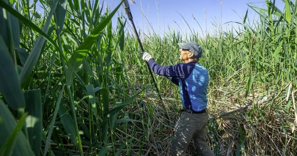
Phragmites at the Great Salt Lake on Tuesday, June 17, 2025.
Originally from Europe and Asia, phragmites took hold in northern Utah after the high flood years of the 1980s receded. The rising salt water had killed off much of the native wetland vegetation at the time.
“It was like a blank slate,” said Keith Hambrecht, restoration program manager for the Division of Forestry, Fire and State Lands. “[There was] all this available bare ground, light and water resources so it could heavily invade.”
In the decades since, phragmites became pervasive across the Great Salt Lake’s wetlands, spilling over into Utah Lake and the Jordan River, and all the other rivers, streams and canals upstream.
“The biggest challenge is definitely the scale,” Hambrecht said.
The reeds spread through rhizomes — a stubborn network of roots — as well as airborne seeds. They grow so thick and tall that duck hunters can get lost and disoriented when trying to wade through them. They obliterate places birds gather to nest, rest and feed, turning them into a monoculture stand.
And they suck up massive amount of water. Utah scientists have calculated the weed suck up 71,000 acre-feet from the Great Salt Lake each season, the equivalent of the Jordan River’s flow for nine months.
State land managers have developed processes to eradicate phragmites, using a combination of herbicides, mowing, burning and cattle grazing.
The Department of Natural Resources ramped up its phragmites removal effort starting around 2014, Hambrecht said, and combined it with planting native wetland vegetation. Their push removed around 88% of the phragmites growing at Utah Lake. They’ve also managed to keep them at bay around Bear Lake along the Idaho border.
“We’ve now really dialed it in,” Hambrecht said.
But the Great Salt Lake is vast, with about 20 times more wetlands than Utah Lake, including patches of phragmites that are remote and difficult to treat. And the tenacious reeds keep bouncing back, compounding the problem.
“It’s probably going to be a forever effort,” said Donnelly, who is working on the tool to better track water-intensive invasive species.

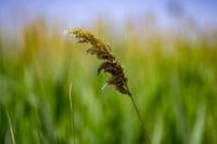
Weeds and phragmites grow on an island on the dry lake bed of the Great Salt Lake on Tuesday, June 17, 2025.
With help from the state, he will use satellite imagery and computer modeling to identify where phragmites and other water-guzzling species like Russian olive and saltcedar (sometimes called tamarisk) grow across northern Utah. The models can filter out phragmites from native cattails and bare ground, Donnelly said.
But first, Ducks Unlimited plans to develop a tool by May that predicts where water collects throughout the basin and creates the conditions that help invasive plants thrive. Then state managers can proactively treat emerging stands before they take root and spread.
“It seems daunting,” he said, “but when you can take pictures and apply these models, it’s really efficient to go in and start mapping it.”
The information will eventually be available on a public-facing website as well, he noted.
The Great Salt Lake Alliance, a nonpartisan group of farmers, businesses and policymakers, chipped in $100,000 to get the project started.
Ducks Unlimited announced an initiative last fall to raise $100 million for Great Salt Lake conservation projects, in concert with Gov. Spencer Cox’s Great Salt Lake Charter 2034.
Much of the Great Salt Lake’s deltas have been engineered into human-managed dikes and ponds to ensure wetlands remain functional.
Those wetlands are critical for preserving bird habitat, Donnelly said, since his research shows that up to 70% of semi-permanent wetlands in the Great Basin have been lost in the last 20 years. With a warming West and increased water use in the region, the formations no longer stay wet for much of the year.
A warming climate also means plants wake up earlier in the spring and grow longer through the fall, making invasive, thirsty plants like phragmites all the more problematic.
“We need to understand those changes,” Donnelly said, “so we can adjust accordingly to the wetlands that we actually can control around the Great Salt Lake.”
The lake’s wetlands are some of region’s last reliable habitat supporting millions of migrating shorebirds and waterfowl as they make yearly migrations across the Western hemisphere.
But understanding where water is during Utah’s warmer months, slashing back the reeds that might otherwise gobble it up, and then moving it across the lake through engineered systems can have benefits for residents of the Wasatch Front, too.
“You can spread that water effectively across the entirety of the exposed lake bed, reducing dust,” Donnelly said. ”It’s all these win-wins for human health, for shorebirds and for water delivery.”
Around 800 square miles of the Great Salt Lake’s lakebed currently sits exposed.
While much of the effort will focus on continued removal of phragmites along the Great Salt Lake itself, the mapping tool will also help land and resource managers control invasive plants in other lakes and rivers across the basin.
“In the ranching communities the West, they call it ‘neighboring up,’” Donnelly said. “You don’t really affect or solve the problem of invasive species unless you’re working with your neighbor.”