A deadly storm wreaked havoc across the eastern half of the U.S., bringing blizzard conditions to the Midwest, tornadoes to the South and torrential rain to the Northeast — and a new storm is on the move.
In the South, they are cleaning up after the wild weather produced up to 428 damaging storm reports from Texas to Maryland, including at least 14 reported tornadoes.
Three fatalities were reported in Mississippi, according to state officials.

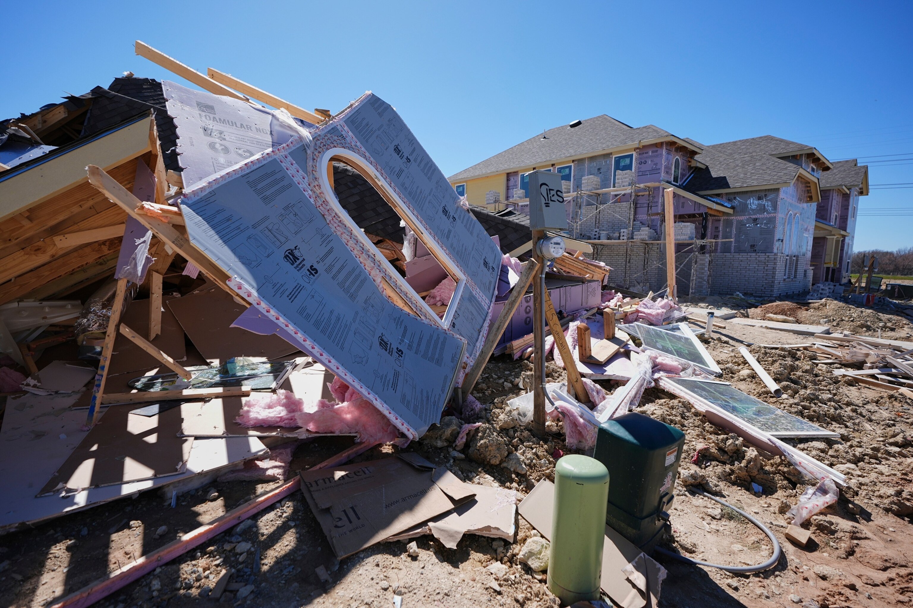
Homes that were under construction sit destroyed after recent severe weather passed through the area in Haslet, Texas, March 5, 2025.
Tony Gutierrez/AP

A homeowner walks around the roots of a downed tree resting on the roof of his house a few hours after a severe storm with gale-force gusts swept through the southeastern part of the country, in Burlington, North Carolina, March 5, 2025.
Jonathan Drake/Reuters
In the Midwest, dangerous whiteout conditions took over roads in Nebraska, Iowa, Minnesota, Wisconsin and Michigan.
The highest snowfall total was in the Upper Peninsula of Michigan, where 2 feet was recorded.
The Twin Cities reported 9.5 inches of snow, marking the biggest snowfall of the season.

In this photo provided by the Iowa State Patrol, a jackknifed semi truck blocks both eastbound lanes on U.S. 20 east of Fort Dodge, Iowa, March 5, 2025.
Trooper Paul Gardner/Iowa State Patrol via AP
In the Northeast, a squall line moved through Wednesday evening, bringing 1 to 2 inches of heavy rain and 50 to 60 mph winds.
The storm now has moved out, but windy conditions are impacting millions across the Northeast, including in Washington, D.C., New York City and Boston.
The winds will increase Thursday night and last through Friday. Gusts of 40 to 50 mph are possible.
Meanwhile, a new storm is hitting the West on Thursday before moving east to the Plains, Midwest and then the Northeast.

Workers clear a layer of ice from a sidewalk at the Liberty Memorial after a winter storm passed through the area overnight, March 5, 2025, in Kansas City, Mo.
Charlie Riedel/AP
One to 3 feet of snow is possible in the Sierra Nevada mountains and the Rocky Mountains.
Rain will continue Thursday for Southern California, including Los Angeles, where thunderstorms are possible. There’s not a major threat for flash flooding, but there could be debris flow in wildfire burn scar areas.
On Thursday evening, the storm system will move into the Plains. Over 6 inches of snow is possible in parts of Nebraska and South Dakota.
By Friday morning, some of this snow will move into the Midwest, including Chicago, and parts of the southern Great Lakes.
On Friday night, light rain showers and snow showers are possible in parts of the Northeast.

