
Some pop-up showers and thunderstorms are possible on Saturday, mainly to the north of areas hit hardest by flash flooding recently, but there is no organized threat of flash flooding today as tropical moisture begins to thin out. No flood alerts are currently in effect.
However, another burst of monsoonal moisture will bring a low threat (Level 1 of 4) of flash flooding to parts of the Desert Southwest Sunday into Monday.

Isolated downpours and thunderstorms could bring localized areas of flash flooding to parts of far southern California and Arizona for Sunday.
For Monday, the low flood threat shifts east into parts of New Mexico.
Any burn scar areas will be especially prone to dangerous flash flooding which could trigger debris flows and mudslides. Burned soil lowers the threshold for flash flooding, meaning even lower rainfall totals can lead to significant flash flooding and other impacts, which unfold quickly.

Into the rest of next week, dry and quiet weather is forecasted for much of the Southwest.
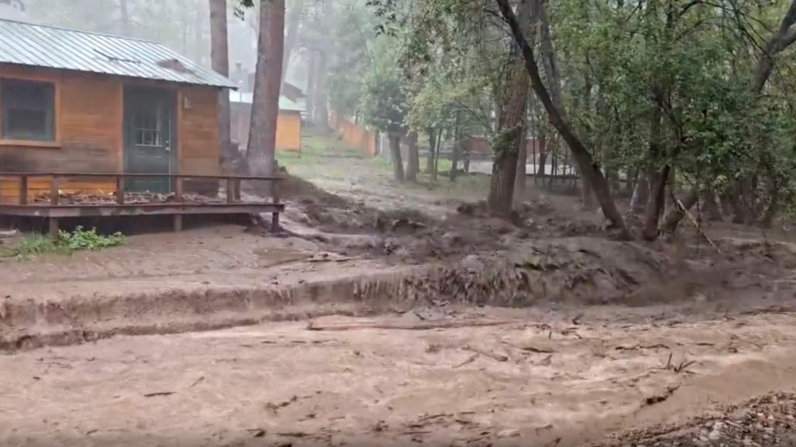
Over the last couple of days, heavy rain and flash flooding drenched the Southwest and even became deadly in one instance.

US 395 was closed due to flooding, in this screen grab from a video released by the California Highway Patrol – Mojave, on Sept. 19, 2025.
CHP-Mojave
In Barstow, California, a 2-year-old was swept away after their family’s car was swept off a road and overtaken by floodwaters. The City of Barstow announced on Friday that “After more than 20 hours of extensive search and rescue operations, emergency responders located the child’s body.”
Flash flooding occurred in other parts of the Southwest as the heaviest downpours dropped 1 to 2 inches of rain in around an hour for some spots, causing some roads to be washed out and anything in the way of rushing floodwaters to be swept away.
Tropical Storm Gabrielle
Tropical Storm Gabrielle continues to churn in the central Atlantic, fighting off unfavorable atmospheric conditions.
Gabrielle is slowly improving in structure late Saturday morning but continues to deal with wind shear and dry air, all conditions that tropical cyclones struggle to survive in.
The storm is expected to move into an area with less wind shear and dry air, as well as warm water, allowing it to likely become a hurricane by late Sunday.

However, it will not bring any direct impacts to land as it stays east of Bermuda early next week and eventually turns northeast across the north-central Atlantic by the middle of next week.
If it does become a hurricane, Gabrielle would become the 2nd hurricane of the 2025 Atlantic hurricane season. On average, the 2nd hurricane forms around August 26, making this hurricane almost a month later than normally expected.
Hurricane hunter flights are scheduled to fly into Gabrielle to get a better idea of the storm’s current structure and strength.
The National Hurricane Center is also watching a weak tropical wave located off the west coast of Africa as it produces some disorganized thunderstorms.

It has a 20% chance of development in the next seven days as it slowly treks across the central Atlantic. If it does become more developed, it would likely take the same track as Gabrielle, avoiding any direct impacts for land.
Tropical activity in the Atlantic is forecasted to slowly ramp back up over the next few weeks as conditions gradually become more favorable for development.
The Atlantic hurricane season runs through Nov. 30.