
Note to readers • This story is made possible through a partnership between The Salt Lake Tribune and Grist, a nonprofit environmental media organization.
March’s heatwave is expected to persist until the weekend, and it’s creating dangerous avalanche conditions in Utah’s backcountry.
The National Weather Service reports Salt Lake City fell just one degree short of the record-high temperature for March on Wednesday, hitting a balmy 79 degrees. The capital city will likely exceed that record Thursday however, and weather stations across the state from Laketown near Bear Lake to Scipio have already seen unprecedented heat for the month.
Elsewhere, places like Salt Lake City, Provo, Cedar City, Wellington and Kodachrome Basin set daily maximum temperature records on Wednesday.
“A lot of these temperatures we’re hitting are more attuned to early June than mid-March,” said Julie Cunningham, a meteorologist with the weather service. “That just goes to show how anomalous this heatwave is.”
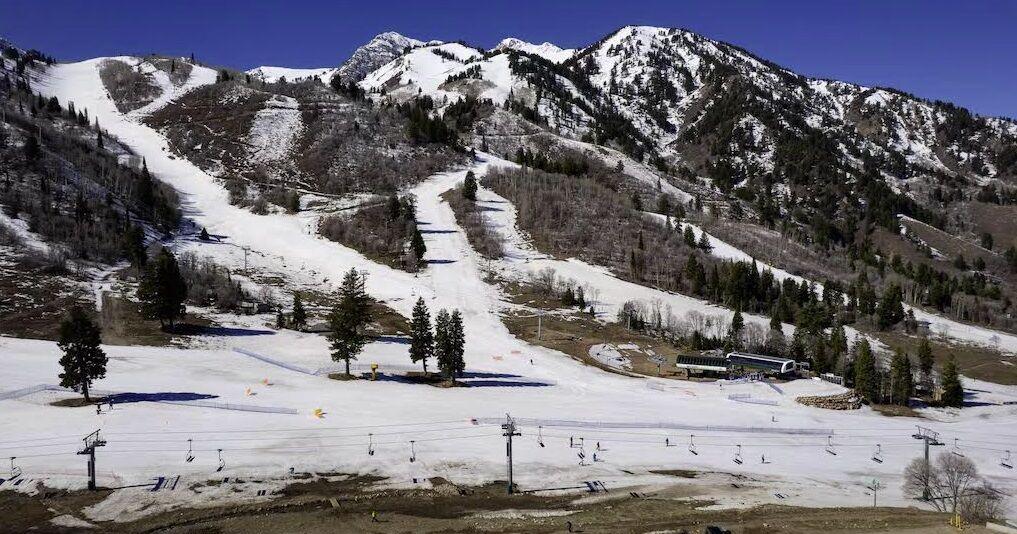
The warm weather hasn’t boded well for the state’s already lackluster snowpack. The Utah Avalanche Center upgraded the backcountry to “considerable” danger as daytime temperatures spike. The large amounts of melting water will create unstable layers and “large, destructive natural avalanches,” the center notes.
A special avalanche advisory is in effect for all mountain regions in Utah from Thursday until 6 a.m. Monday.
“Wet avalanches could occur on all aspects and at all elevations,” the avalanche center reports, “including places that typically stay colder this time of year.”
The National Weather Service noted that cooler temperatures could settle over the state over the weekend, but temperatures will stay unseasonably warm.
“We’ll still be 10 to 15 degrees above normal,” Cunningham said.
The forecast also looks bone-dry, with any rain or new snow in the next week unlikely.
Snowpacks across Utah remain well below average for this time of year, according to National Resources Conservation Service data.
The northeastern Uintas and Raft basins have fared the best this season, with snowpacks at 73% and 78%, respectively, of the 30-year median. The Bear River, Weber-Ogden and Duchesne basins range are between 52% and 66% of normal. All other watersheds in Utah have snowpacks that are less than half of normal for this time of year.
Astronomical spring officially begins Friday.