A large swath of residents along the Eastern Seaboard is under flood and wind alerts as the storm system that inundated the South moves north, bringing the same threats with it.
Residents living along the I-95 corridor can expect a dangerous commute on Monday morning as heavy rain and strong winds continue to affect the region.

The National Weather Service has issued a flood watch across 16 states, affecting 70 million people, while 50 million are under some type of wind alert.
Parts of Florida have gotten up to 5 inches of rain since Saturday from the same system.
Fort Lauderdale picked up 1.07 inches of rain on Saturday, bringing their record-smashing total rainfall for 2023 to 111 inches. The region has gotten more than 9 feet of rain in the last 11 and a half months, according to the NWS.
Orlando and Daytona Beach saw about 2.5 inches of rain, while Melbourne got more than 3 inches.

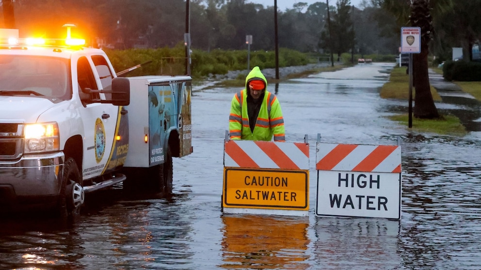
A public works employee inspects a flooded intersection in Tarpon Springs, Florida, Dec. 17, 2023, following heavy rains in the area.
Douglas R. Clifford/Tampa Bay Times via Zuma Press
Flood watches were in effect for parts of northeast Florida, including Palm Coast, Ocala and Palatka, until 6 a.m. Sunday.
Heavy rain continued on Sunday morning in Jacksonville and Gainesville, which have gotten more than 3 inches of rain so far. A flood watch remained in the region until 10 a.m.
Cross City, in the Big Bend of Florida, neared the 5-inch mark as rain continued on Sunday morning, as the system pushed north into Georgia and the Carolinas. A flood watch is in effect in Charleston, South Carolina, until 1 p.m.
Severe thunderstorms are also possible on Sunday across the coastal Carolinas, including Charleston, and Wilmington, North Carolina. The main hazards are expected to be damaging winds and a tornado threat, along with flooding.

Heavy rain will continue from South Carolina to North Carolina, Virginia and Delaware through 6 p.m. Washington, D.C., and Baltimore will begin to see heavy rain around 6 p.m., forecasts show.
New York City will begin to see the most consistent downpours around midnight. The worst of the storm as far as heavy wind and rain will blow through New York City through the overnight hours.
The remainder of the watches up the East Coast extend into Monday.
Heavy rain will be more isolated in New York City by 7 a.m. Monday, as the heavy rain moves farther north, into upstate New York and the rest of New England.

The flood and wind alerts will begin in upper New England late Sunday and extend through Monday into Tuesday morning — the last expiring at 7 a.m. in Bar Harbor, Maine.
A high wind warning is in effect for the New England Coast, with wind gusts up to 65 mph expected. This will include Long Island, New York; Providence, Rhode Island; Boston and Portland, Maine.

Due to the strong winds bringing higher storm surges, coastal flooding will also be a widespread issue, with 20 million people under coastal flood alerts.

