
More than 4 million people remain under a flood watch through Saturday evening in Miami and Fort Lauderdale, Florida. Scattered showers are expected Saturday, much lighter than last week, but still enough to cause ponding and flash flooding because there is nowhere for new rainfall to go.
Over the last seven days, Miami and Fort Lauderdale have both officially seen more than 14 inches of rainfall.

The amount of rain that Miami and Fort Lauderdale received in the last seven days constitutes a 25-year event. There is a 4% chance this type of rain event happens any given year.
This is based on climate records specifically for this area, but rapid human-induced climate change is amplifying heavy rain and prolonged flood events.
Sunday is finally looking like a “mostly” dry day for the South Florida region. There is inevitably always a chance for a pop-up thunderstorm for this area, and that will still be the case on Sunday, but there isn’t expected to be an onslaught of continuous rain.

A woman sweeps out her home in the flooded Green Acres Village in Hallandale Beach, Florida, on June 13, 2024.
Mike Stocker/South Florida Sun Sentinel via TNS via Newscom

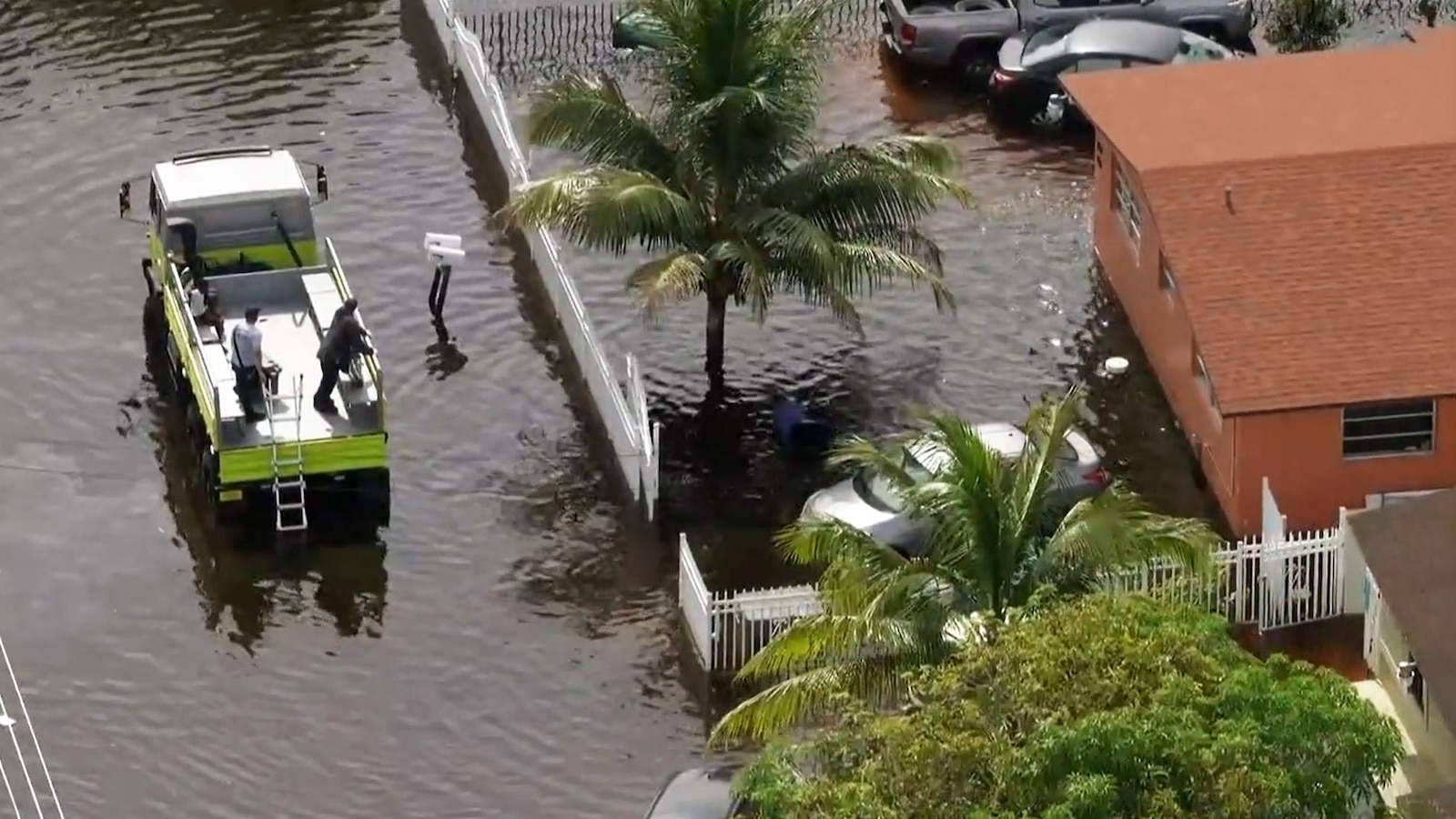
In this screen grab from a video, flooding is shown in Miami, on June 14, 2024.
WPLG
Severe weather
The heaviest rain this weekend is expected to fall in the Upper Midwest from Wisconsin to Nebraska, where a severe risk exists.
Later Saturday afternoon and into the overnight, strong supercells will have the chance to form over cities like Omaha and Lincoln, Nebraska, and Des Moines, Iowa. These storms have the potential for a few tornadoes as well as damaging winds and large hail. Heavy rain may also lead to flash flooding.
On Sunday, the threat for damaging wind, large hail, and flash flooding is from Rapid City, South Dakota, to Minneapolis, Minnesota.
The threat for scattered severe storms on Monday is mainly for the Dakotas and Minnesota.
Excessive heat
An excessive heat warning is in effect through Sunday for parts of Arizona and southern California.
Phoenix, Arizona, could reach 113 degrees while Tucson could reach 110 degrees. This is a Major Heat Risk.
In southern California, Palm Springs and Imperial could reach temperatures between 115 and 118 degrees Saturday.
El Paso, Texas, could reach a heat index value over 100-degrees, leading to an Excessive Heat Warning for that area through the weekend.
Record heat moves east

A heat dome is setting up and getting ready to move east across the country in the coming days, bringing a chance for record-breaking daily temperatures, and the hottest conditions of the year so far.
On Sunday, cities like St. Louis, Missouri, Nashville, Tennessee, and Little Rock, Arkansas will all rival daily record high temperatures, and their hottest temps of the year so far, with potential high temps around 100-degrees.
The Extreme Heat Risk on Monday is for an area from Kansas City, Missouri, to St. Louis, Missouri, to Des Moines, Iowa, and the Quad Cities.
The potential for record daily highs could occur in Chicago, St. Louis, Indianapolis, Louisville, Columbus, Cleveland and Pittsburgh.
On Tuesday, the Extreme Heat Risk is for Chicago, Green Bay, Indianapolis, nearly all of Michigan including Detroit and Grand Rapids, Cincinnati and Louisville.
Thursday is expected to be much of the same as Wednesday, with the Extreme Heat Risk creeping into the Northeast and now including areas from Ohio to Maine — possibly even including New York City for the first time this year.