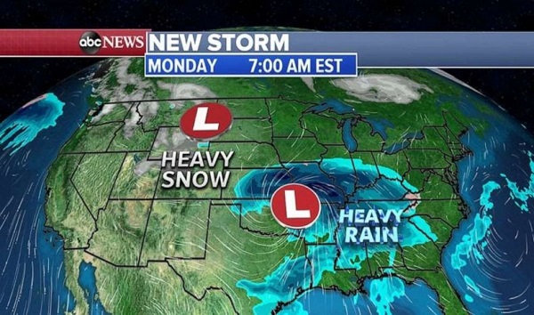
 iStock(NEW YORK) — Two storms will move across the country and combine in the East to bring heavy snow and rain from the Rockies to the East Coast.
Already yesterday, Phoenix had the rainiest day since October 2018 when they got more than 1 inch of rain. Several MLB practice games had to be cancelled or delayed yesterday in Phoenix, Arizona due to the record daily rainfall.
In northern Arizona and New Mexico, up to 15 inches of snow fell and is still snowing.
As these storms move east, 13 states from Washington to Arizona and east to Missouri are under flood and snow alerts.
This morning these storms are moving through the West with one bringing heavy snow and rain to the Pacific Northwest and the other one in the Four Corners region of the southern Rockies.
Snow is also expected in Denver today but the heaviest will be just to the south and west of the city.
By Monday morning, the southern storm moves into the Plains and should bring heavy rain to the area where Flood Watches have been posted. Rain will also move into the very saturated south from Texas to Georgia where many rivers are still in flooding.
The northern storm is expected to move through the northern Rockies and into the northern Plains with heavy snow.
On Tuesday morning, however, these storms will begin to combine into one in the Midwest, bringing a hit of heavy snow to the Upper Midwest and the Great Lakes and possibly Chicago.
To the South, heavy rain and thunderstorms are expected in the water logged states from Mississippi to the Carolinas!
Take a look at the snowfall forecast in the Rockies and the Upper Midwest and the Great Lakes, some areas could see more than a half a foot.
The rain will be the heaviest from Kansas to South Carolina where some areas could see more than 2 inches of rain with some possible flooding.
Copyright © 2020, ABC Audio. All rights reserved.

